


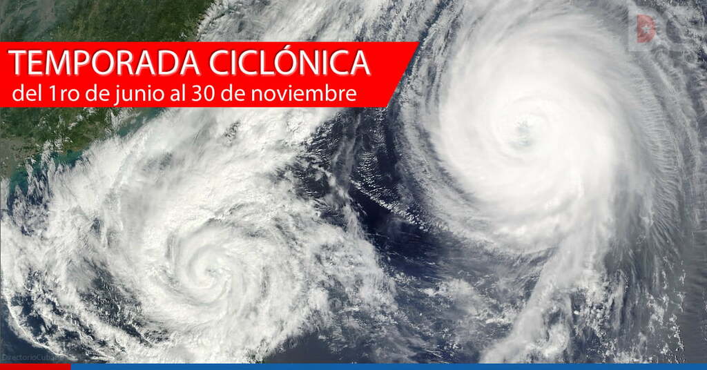
HAVANA, Cuba, Aug 1 ACN) The cyclonic season in the geographical area of the tropical Atlantic Ocean, including the Gulf of Mexico and the Caribbean Sea, begins to heat up during the eighth month of the year, confirmed specialists from the Weather Surveillance Center of the Institute of Meteorology.
A demonstrative fact is that its occurrence increases during the second half of August, which, along with the first half of September, constitutes the period of maximum activity of the dangerous semester from the hydro-meteorological point of view, from June 1st to November 30th.
So much so that in September 2002 and August 2004 a total of eight occurred, which constituted the monthly record for the most cyclones that receive their name when they exceed the tropical storm phase, according to historians of the sector.
However, in the case of Cuba, August is the third most dangerous month for tropical cyclones, after October and September, when they are usually accompanied by an extensive area of clouds with showers, rains, thunderstorms and even tornadoes.
A list of the most significant hurricanes that hit the country in the course of this century includes Charley in 2004, whose center penetrated the mainland along the southern coast of the then province of Havana in the early morning of the 13th, with category 3 on the Saffir-Simpson scale, with maximum sustained winds of 180 kilometers per hour and gusts exceeding 200 km/h.
In addition, in 2008, Gustav, category 4, on August 30, 2008, crossed the western portion of the Isle of Youth and then touched the land in Pinar del Rio at a point on the southern coast of the municipality of Los Palacios, where it caused considerable material damage.
At the time, the Paso Real de San Diego weather station recorded an impressive gust of 340 kilometers per hour, the highest wind speed officially measured in the archipelago.
Other extremely strong storms included Camille in 1969, Allen in 1980, Andrew in 1992 (which devastated areas of southern Florida), and Katrina in 2005, which caused a major disaster in the U.S. city of New Orleans.
Cuba is one of the few nations in the region that prepares its own forecasts for the current cyclonic period, which are in charge of the Forecast Center, together with the Climate Center, both of the Institute of Meteorology, belonging to the Environment Agency of the Ministry of Science, Technology and Environment.
Specialists of the institution agreed in describing the new campaign as active, when in its months 17 tropical cyclones could form in the whole North Atlantic basin, of which nine could reach the category of hurricane.
They specified that, of these, 12 will develop in the Atlantic oceanic area, three in the Caribbean Sea and two in the Gulf of Mexico, when there is a high probability that at least one hurricane will originate and intensify in the Caribbean (60%) and that one of Atlantic origin will penetrate this sub-region (75%).
They warned that there is a high risk that Cuba will be hit by at least one tropical cyclone, with an 85% chance, and at least one hurricane category, with a 60% rate.
This period will last one semester and regardless of the probable number of tropical cyclones for the Atlantic Basin, the most important thing is to be ready and attentive in order to eliminate and reduce vulnerabilities, in order to protect the life and property of the popular and personal economy.
According to the list approved by the Hurricane Committee of Region 4 of the World Meteorological Organization, to which Cuba belongs, their names are Alex, Bonnie, Colin, Danielle, Earl, Fiona, Gaston, Hermine, Ian, Julia, Karl, Lisa, Martin, Nicole, Owen, Paula, Richard, Shary, Tobias, Virginie and Walter.
Tropical cyclones are named once they reach the tropical storm phase (from 63 to 118 kilometers per hour).
Based on their maximum sustained winds averaged in one minute, they are classified as tropical depressions when they are less than 63 kilometers per hour; tropical storms from 63 to 118 and hurricanes if they are equal to or greater than 119.
In the specific case of hurricanes, the Saffir-Simpson scale divides them into five categories.
The first category includes those with maximum sustained winds of 119 to 153 km/h; the second from 154 to 177; the third from 178 to 208; the fourth from 209 to 251 and the fifth from 252 km/h, while from the third onwards they are called hurricanes of great intensity.
Caribbean Sea shows signs of an active cyclonic season in August
Nos reservamos el derecho de no publicar los comentario que incumplan con las normas de este sitio